Linking Nature and History The Frederick G. Todd Landscape Plan (Part 1)
Part One of a Three-Part Series: The “Main” Entrance and Cove Fields
On June 13, 2026, the Plains of Abraham Museum debuted Natura & Historia, a new exhibition that invites visitors to explore how the land now encompassing Battlefields Park has evolved over time. Among the key eras showcased is the creation of the park itself in 1908.
At the time, the commissioners—led by George Garneau, Mayor of Québec City and Chairperson of the National Battlefields Commission—hired landscape architect Frederick G. Todd to design a development plan for the park. The core principles of his vision continue to shape how this historic site is preserved and showcased today. To bring his ideas to life, Todd accompanied his report with a series of photographs documenting the various sectors destined to become the Plains of Abraham and Des Braves Park.
Through the 12 photographs Todd used to illustrate his report, this first instalment invites you to step back into 1908, see the landscape through his eyes and discover the vision behind his plan.
THE EAST ENTRANCE
The Quebec Skating Rink and the fortifications
The plan called for the area Québec City residents once knew as Cove Fields to become the easternmost section of Battlefields Park. For Todd, Cove Fields would serve as the historic heart of the future park, dedicated to commemorating the battleground of 1759.
FIRST, that portion from the Citadel to Wolfe’s monument, which consists largely of a high undulating plateau, broken by small elevations. This portion of the park I have endeavoured to keep as natural and informal as possible, and, at the same time, have avoided planting many trees, in order that it may remain as near as possible in the condition in which it was when the historic battles took place.
Todd also envisioned this sector as the park’s main entrance. However, he faced a major obstacle. In 1908, an imposing building stood on this plot of land just south of Grande Allée Avenue: the Quebec Skating Rink, built in 1889.
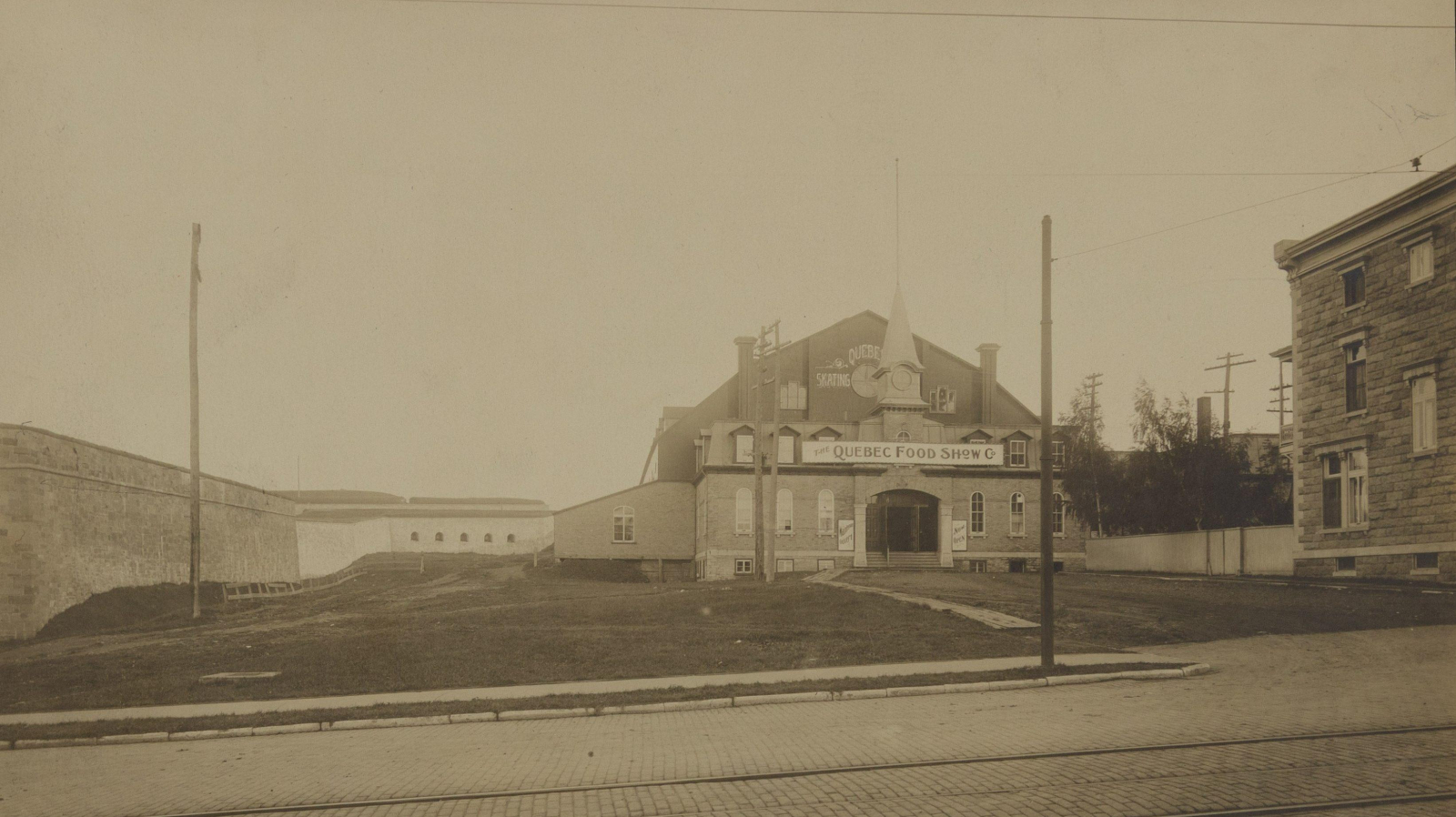
Beginning in 1877, a succession of three skating rinks occupied this area. The first was set up near the Saint-Louis Gate, north of Grande Allée. The second, built south of the avenue, sat on the exact same site as the one visible in the photograph. Rushed into construction in 1889, it proved short-lived: the temporary structure collapsed that very winter, in 1890.
The third skating rink, constructed on the same site in 1891, is the building seen in this photograph. This grander structure housed not only an ice rink but also curling lanes and a bowling alley. Its primary tenant was the Quebec Hockey Club, nicknamed the Bulldogs. Among the legendary players to wear the team colours were Joe Malone, Joe Hall and Paddy Moran. This powerhouse team captured the Stanley Cup in 1912 and 1913 while playing out of the Quebec Skating Rink. Beginning with the 1913–1914 season, the team relocated to the Parc Victoria arena in Lower Town.
Beyond hockey games, the Quebec Skating Rink hosted galas, special events, fairs and public skating sessions, as captured in the photograph. Destroyed by fire in 1918, the building was never rebuilt. This ultimately allowed the National Battlefields Commission to clear the land and create the main entrance originally envisioned by Frederick G. Todd.
Indeed, this entrance was designed with a very specific purpose in mind:
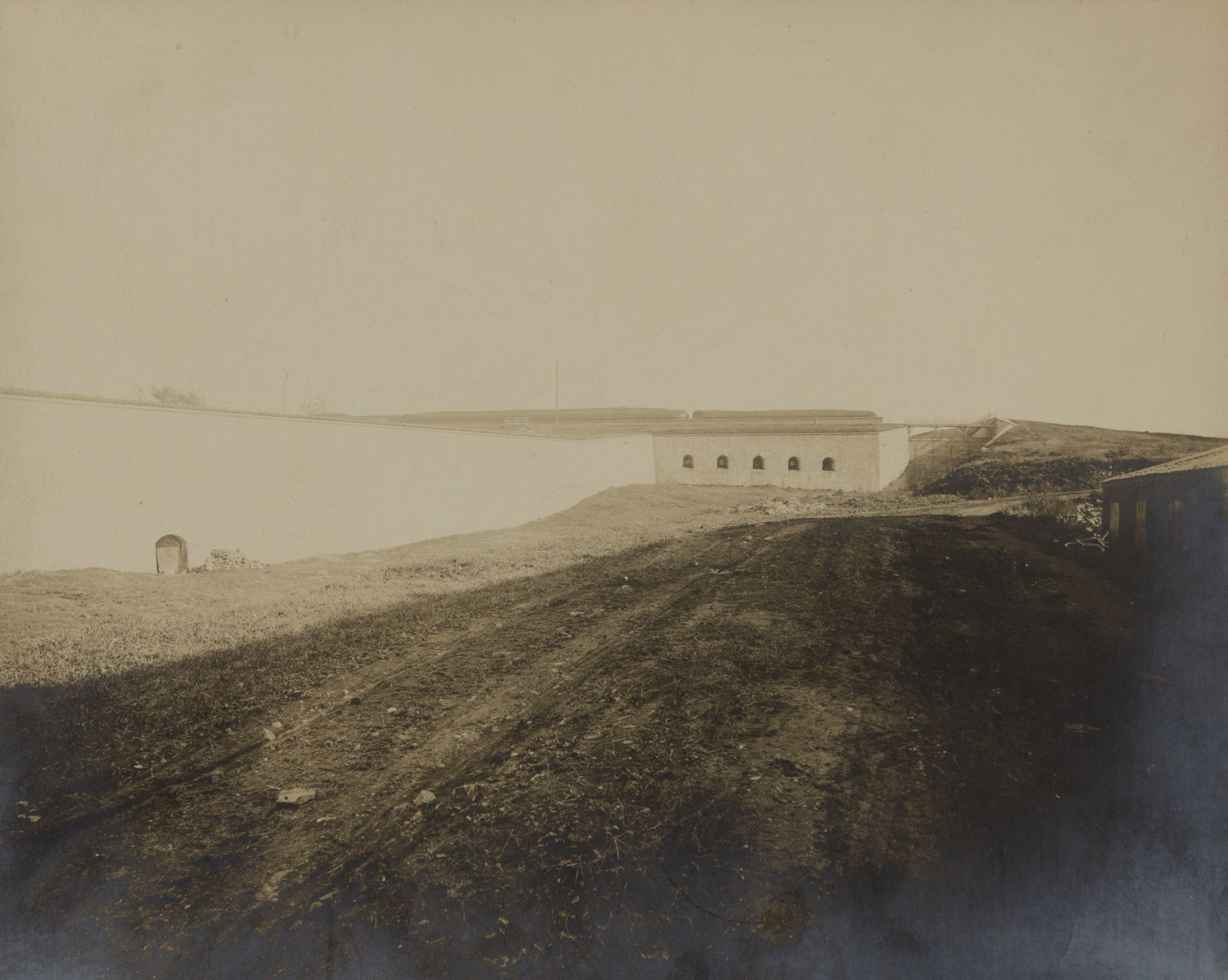
One of the most important and effective features of such an entrance would be that the instant you have passed through the gateway you obtain a most striking and impressive view of the Citadel fortifications, which would help greatly to carry out the prevailing idea of the park. Photograph No. 3 gives an idea of what this view would be, although if the rough material which has been dumped near the rear of the present skating rink were removed, the view would be even more effective than the photograph shows.
This photograph offers a glimpse of the “essence of the park” that Todd hoped to reveal. Rising on the left side of the image is the commanding fortifications of Québec City. Built according to the plans of French military engineer Gaspard-Joseph Chaussegros de Léry, with construction beginning in 1745, this perimeter wall was designed to protect the city from enemy attack. The wall also features a small opening known as a postern, a narrow passageway built into the fortifications to provide access to the city when the main gates were closed, particularly during times of conflict when authorities imposed a curfew.
In the background stands the Glacière casemate, a small guardhouse located just outside the Citadel wall and seamlessly integrated into the adjacent fortress. The openings in the wall are embrasures for artillery pieces, designed to maximize the fortifications’ firepower.
The Cove Fields
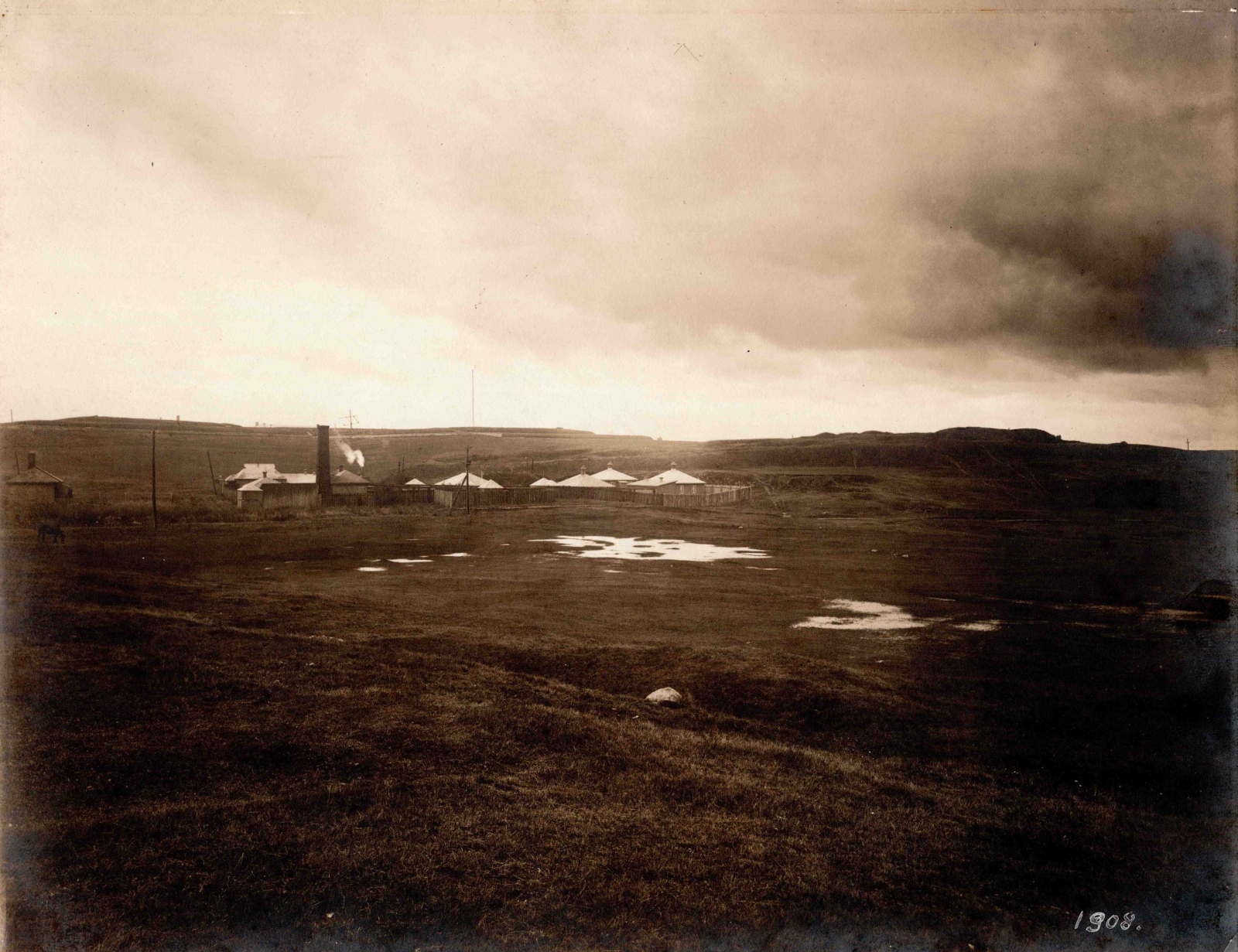
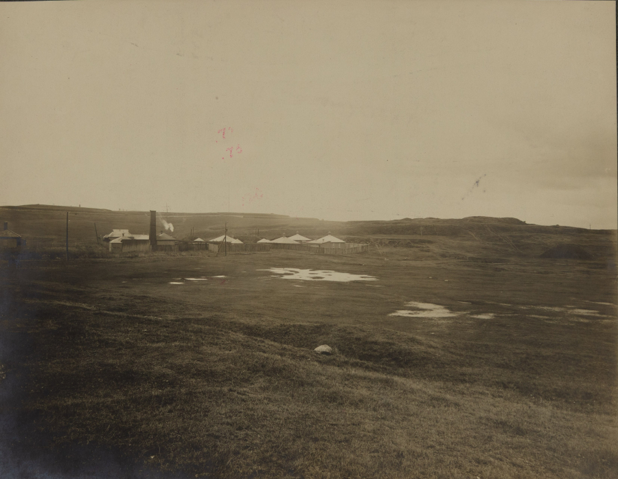
Continuing east, we encounter Cove Fields. In 1908, Dominion Arsenal was located in this area. Established by the Government of Canada in 1879 under the name Cartoucherie de Québec, the facility’s mission was to manufacture ammunition. While the main operations were based in a complex near the Saint-Jean Gate, some of the most hazardous tasks involved in ammunition assembly were transferred to the buildings visible in the photographs, which were enclosed by a simple wooden fence. Several women worked here, notably assembling .303 calibre cartridges.
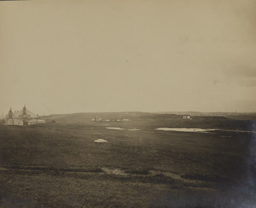
The sixth photograph offers a striking view of the sector. The Citadel dominates the background, while the south shore of the St. Lawrence River is seen in the distance. In the foreground, targets used by employees of the Ross Rifle Company to test their weapons are also visible. Located slightly farther west, right next to Martello Tower 1, this factory produced the famous Ross rifle. Adopted as the official weapon of the Canadian infantry during World War I, the Ross rifle was withdrawn from service in 1917 due to reliability issues. On the left side of the image stands the Armoury, built in 1885 according to the plans of architect Eugène-Étienne Taché.
As Todd envisioned this sector as the historic heart of the future park, he also wanted it to be traversed by a major thoroughfare, now known as George VI Avenue. This route would allow visitors to travel across the entire park. Referred to as “Road No. 1” in his report, he described it as follows:
I have so designated the drive leading from the Main Entrance as far as Wolfe’s monument. After passing through the main gateway, where one is confronted by the impressive view of the Citadel, this drive curves out into the broad valley in the rear of the Drill Hall, and gradually ascends the hill, on which are located the Martello Towers, where a most beautiful view of the entire easterly section of the park is obtained as shown in Photograph No. 5. This view is of course at present badly marred by the Dominion Arsenal Buildings. It is also somewhat difficult to realize of form a proper appreciation of this view, because its proportions and distances are so large and there is nothing at present to give it scale. A few well places groups of trees would make a great difference in the view, and afford the eye the necessary scale to properly grasp its proportions.
In our next instalment, we will follow the Frederick G. Todd plan over to the Cap Diamant sector. We will explore several landmarks of the built heritage he fought to preserve and showcase, including the Martello Towers, the astronomical observatory and the Former Québec Prison.
Images: CCBN Archives